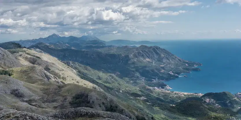
The mountains around Kotor rise sharply from the bay into true mountain terrain. In a short drive - or a sustained climb straight from town - you can swap stone streets for ridge paths and limestone viewpoints. That's what makes hiking in Kotor unusual: medieval towns and serious mountains sit side by side.
The three hikes below are some of the best hikes around Kotor, each with different terrain and difficulty. Vrmac Ridge follows an old military road with views over the bay. Pestingrad is a shorter climb to a limestone summit. Babina Glava goes deeper into Lovćen National Park through beech forest and open karst.
If you want the GPX tracks, parking pins and step-by-step notes for these routes, download the Kotor Trail Pack or read the complete Kotor hiking guide.
Kotor Hiking Trails
Vrmac Ridge

The ridge walk between Kotor and Tivat bays. The trail follows an old Austro-Hungarian military road built in the early 1900s, mostly uneven stone and packed earth. Fort Vrmac sits near the high point - you can explore the tunnels if you bring a headlamp.
Why hike it: You see both bays from the same trail. The path is wide and well-defined, good for a first mountain hike in the area. The fortress tunnels are completely dark but safe to walk through - just watch your head on the low ceilings.
Pestingrad

A short climb to a limestone summit in Lovćen National Park. The path is rocky and exposed in places. Near the top there's a fixed rope for the final scramble - it's not technical, but you'll want dry conditions and decent grip on your boots.
Why hike it: The summit has clear views in all directions - Kotor Bay below, the Adriatic to the west, and the Lovćen massif inland. It's quieter than the main tourist viewpoints. The wind picks up on top, so bring a layer even if it's warm at the trailhead.
Babina Glava
The longest of the three hikes, climbing through beech forest before opening onto high karst meadows. Locals call it the Wolf Trail (Vučija staza). You'll pass a few old stone shepherd huts on the way up - some are still used in summer.
Why hike it: The 1,756m summit gives you a full view of the Dinaric range. The forest section stays cool even in summer. There's no water on the trail, so carry what you need. Early morning is best if you want to see wildlife - deer tracks are common on the upper section.
Hiking Tips for Kotor
- Summer heat: July and August regularly hit 35°C. If you're hiking in summer, start by 7 AM. Carry 2+ liters of water per person.
- Water sources: None of these trails have reliable water. Bring everything you need from the start.
- Terrain: Vrmac is mostly packed earth and stone. Pestingrad and Babina Glava are rockier. Ankle-supporting boots help on uneven ground.
- Best seasons: April to June and September to October. Cooler temperatures, fewer people, and the trails are usually dry.
- Navigation: Phone signal drops in and out once you're above the bay. Download offline maps or GPX files before you leave town. The Kotor Trail Pack includes tested GPX routes for all three hikes.
Guided Hikes and Trail Packs
Hike with a local guide or pick up the self-guided trail pack with offline GPX files, parking coordinates, and route notes.