The Peaks of the Balkans (POB) is a 192 km trekking route through the Accursed Mountains (Prokletije) across Albania, Kosovo, and Montenegro. It’s a mix of alpine passes, remote valleys, and small mountain villages - one of the few places in Europe where long-distance hiking still feels unrushed and authentic.
Trail Facts
- Distance: 192 km
- Duration: ~10 days (shorter options available)
- Total Ascent: ~10,000m+ (steep, alpine-style terrain)
- Countries: Albania, Kosovo, and Montenegro
- Best Season: Late June to mid-September
Why People Hike It
It’s one of the last places in Europe where you can cross two international borders in a single day on foot, ending the evening in a small family run guesthouse rather than a polished hotel. You aren't just seeing the mountains; you're seeing a way of life that has barely changed in decades, fueled by strong coffee and homemade rakija.
What to Know Upfront
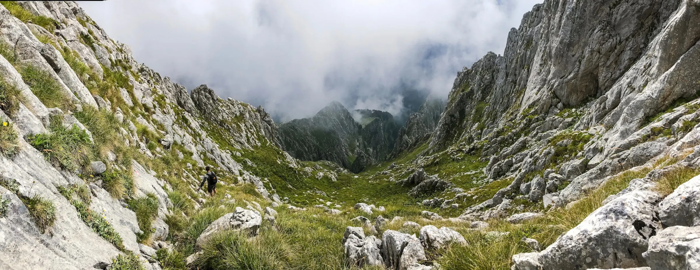
Signage is inconsistent in places, especially in the high karst sections, so don’t rely on waymarks alone. Some “green border” crossings require permits from the police, and they need to be arranged before you arrive. Many stages involve 1,000m+ of ascent, which feels harder if you’re carrying your full pack.
None of this is meant to put you off. It’s a brilliant route and rewards having the essentials sorted ahead of time: reliable GPX tracks, offline navigation, correct gear, and a plan for accommodation.
Trail Route Overview
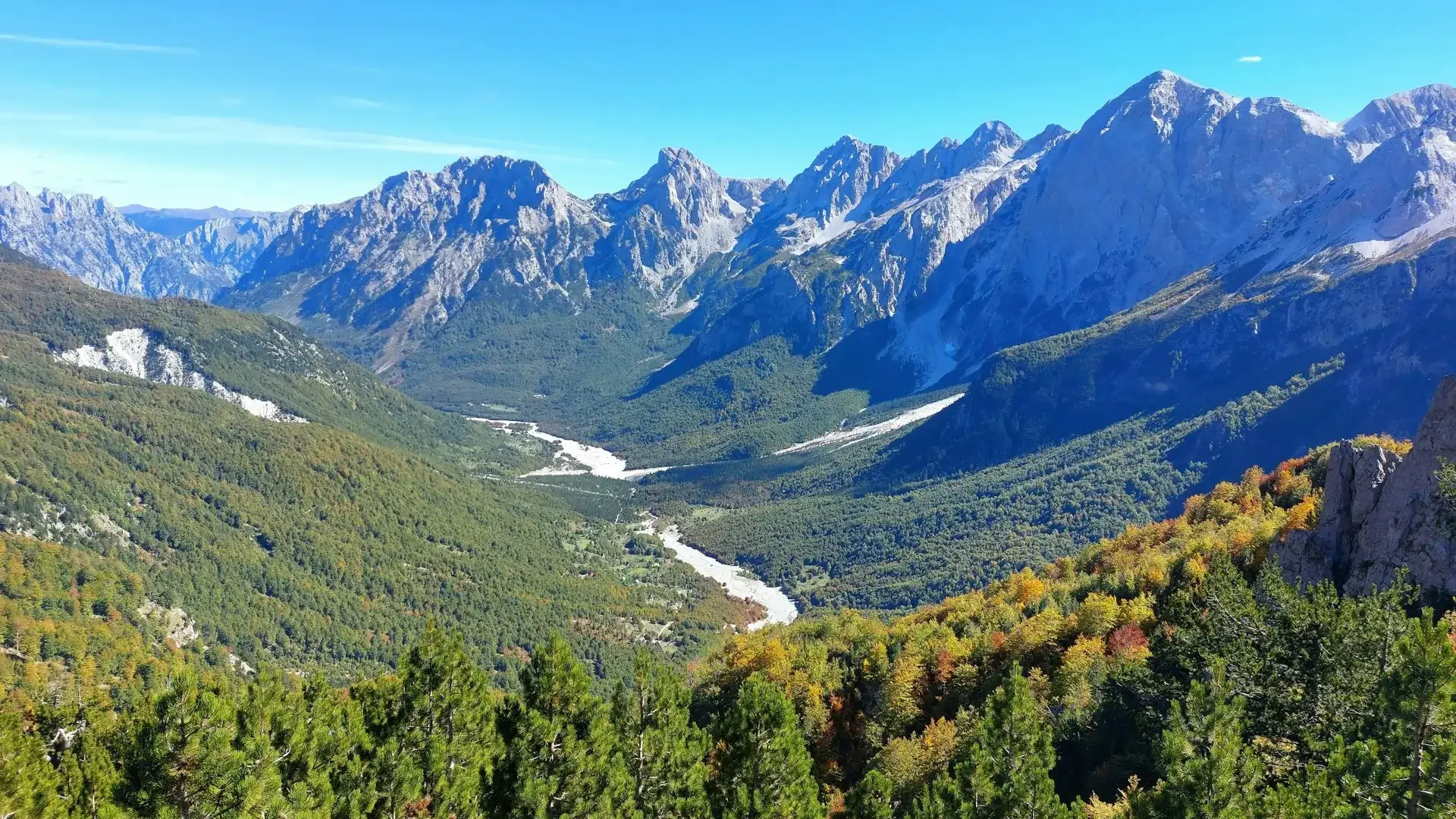
Most hikers complete the Peaks of the Balkans in around 10 days, travelling anti-clockwise from Plav. The full traverse crosses high passes in Albania, Kosovo, and Montenegro with daily elevation gains that feel closer to the Alps than a classic European long-distance trail.
Below is the shape of the route - the full distances, timings, and alternates are included in the Trail Pack.
Classic 10-Day Structure
- Day 1–3: Plav → Vusanje → Theth → Valbona (high passes + border permit use)
- Day 4–6: Valbona → Çerem → Dobërdol → Milishevc (remote sections + logistics)
- Day 7–8: Milishevc → Reke e Allagës → Rest to Liqeni (exposed passes, weather calls)
- Day 9–10: Rest to Liqeni → Babino Polje → Plav (re-entry to Montenegro + exit options)
Best Time to Hike the POB
The prime window is late June to mid-September.
The Snow Factor: Even in June, high passes can hold steep snow patches that require care. By late June these are usually manageable.
The Heat & Water: August is the driest and busiest month. If you hike then, sun protection and water are priorities.
The Shoulder Season: May and October are beautiful but high-risk. Expect freezing temperatures at night and the very real possibility of being turned back by snow. Many guesthouses are seasonal and will be closed outside of the core months.
Choose Your Own Adventure
How do you want to hike?
The Independent Path: If you're comfortable managing your own logistics and want full flexibility, the €50 Trail Pack gives you verified GPX files, border permit steps, and accommodation contacts to plan without guesswork.
The Supported Path: If you want to hike independently but don't want the admin, the Trail Ready Package handles accommodation booking, border permits, transfers, and your route pack — with a guide on WhatsApp throughout. €100/person.
The Guided Path: If you'd rather have someone handle weather calls, border admin, and route decisions so you can focus on the hiking, a guided tour is the straightforward option.
What You’ll Need - Overview
- Broken-in hiking boots
- 40-60L Pack
- Layering system
- Offline maps + backup navigation
- Cash (not all villages take cards)
- Basic first aid + headtorch + whistle
Fitness Requirements
Expect 4–8 hours of hiking per day, often with 800–1,200m of climbing on rocky alpine paths. You don’t need to be an athlete, but you should be comfortable with back-to-back days on steep ground and carrying your pack.
If you haven’t done multi-day hikes before, prep is important:
- Weekend hikes with a loaded backpack
- Basic leg strength (lunges / step-ups)
- Getting used to uphill/downhill on uneven terrain
The trail is much more rewarding when you arrive prepared rather than improvising.
Safety & Logistics
This is a remote, alpine trail with patchy phone signal and mixed signage. You’ll be making decisions without immediate help. The biggest things to get right are:
- Navigation: offline GPX + backup, not just trail marks
- Borders: some sections need permits before arrival
- Weather calls: snow on passes, storms in the afternoons
- Accommodation: seasonal openings - not all villages operate year-round
Getting There
Start from Plav with access from Podgorica Airport (Montenegro). Tirane Airport (Albania) is also a good option with more international connections, though it has a slightly longer transfer to the trailhead.
Choose Your Style of Hiking
Self-Guided (Supported)
Accommodation, permits, transfers, route pack, guide on call
€100 Trail Ready Package